By Mondal Falgoonee Kumar, National Forest Inventory (NFI) Analyst of the Forestry Division, Food and Agriculture Organization of the United Nations (FAO), Rome, Italy
Sierra Leone used Collect Earth Online (CEO) to collect data for their National Forest Inventory (NFI) field inventory sampling frame design. To support and implement their work, the team has created an interpretation key to guide data collection, enabling accurate classification of Sierra Leone’s diverse landscape. The insights Mondal Falgoonee Kumar provides in creating an interpretation key can help our global community of users to create their interpretation keys.
Sierra Leone’s National Forest Inventory (NFI) will be implemented using a two-phase sampling strategy. The first phase focuses on remote sensing-based assessments to identify and estimate land cover, forest type, and crown cover. This phase uses CEO to conduct stratification.
The data generated in this phase is crucial to the success of the second phase, where a field assessment sampling frame will be created for multiattribute field data collection. This also will validate the remote sensing data collected from the first phase. The quality and precision of the dataset obtained from CEO are vital for effective stratification and sampling design, minimizing errors, and enhancing efficiency.
A key component in collecting robust data using CEO is creating a good Interpretation Key. This key guides data collectors in accurately identifying and classifying land cover types, ensuring consistency and reliability across the dataset. The success of the entire inventory depends on the effective use of the Interpretation Key, making it an essential part of the NFI process in Sierra Leone.
Briefly, an interpretation key is a guide for interpreters to help them accurately and consistently identify land cover when collecting data in CEO using satellite images. A good Interpretation Key includes images representing different class levels, provides guiding information, and includes details that are vital for robust point identification and analysis. Sierra Leone’s interpretation key uses this information to lead users through hierarchical decision trees to help them classify land cover types into different classes.
Sierra Leone has diverse land cover types, including multiple types of forest. High quality CEO land cover classification data that accurately represents these land covers is required to create a representative sampling design for the second phase of the NFI where field data will be collected. In addition, the classification data will be used for area estimation and reporting of forest cover, non-forest cover, and different forest types. A good interpretation key helps ensure accurate classification of diverse land covers.
Accurate reporting and monitoring also requires aligning various levels of classification systems—such as those of the UNFCCC, FRA, and national standards. One challenge in Sierra Leone is the multitude of national classes (over 60), many based on physical ground use, which are difficult to distinguish using satellite images. Identifying representative images and guiding details for rare classes also poses a challenge. Additionally, some crucial land cover types like Inland Valley Swamp are not included in any land cover classes. These complexities in Sierra Leone imply more confusion for data collectors, which makes the role of a proper interpretation key more prominent. A good interpretation key organizes and simplifies these different levels of classification systems and provides examples of each class for data collectors.
These issues highlight the necessity of an informative and proper interpretation key to drive the process and achieve accurate estimates, reporting, and planning for the next sampling phase.
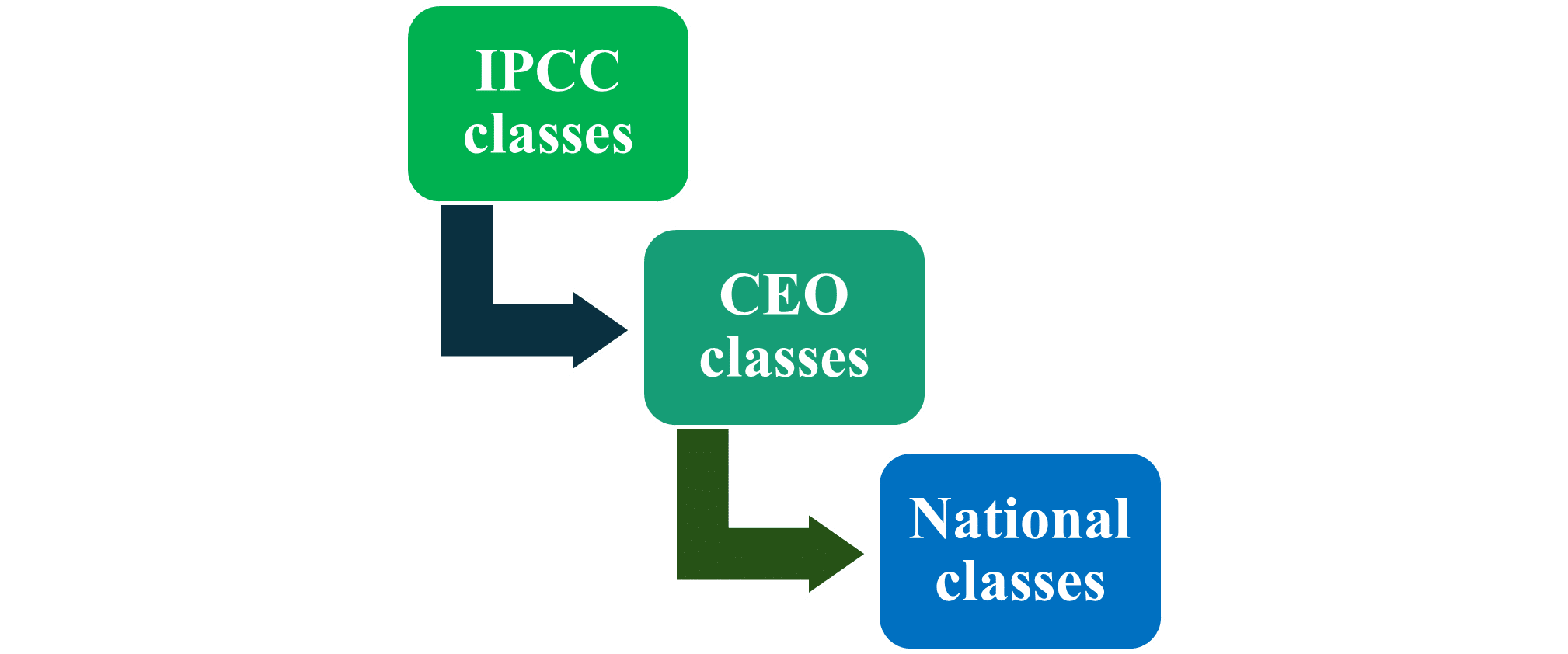
The team developed a tiered approach to land cover classification in CEO. Sierra Leone has adopted the Intergovernmental Panel on Climate Change (IPCC) classification system. Thus, the top level of land cover classification corresponds to standard IPCC classes.

The second level of classification was developed for CEO to account for land cover identification using satellite imagery. It was derived by aggregating Sierra Leone’s National Land Cover Classes (the third level of classification). CEO classes are kept aligned with the UNFCCC classes. The National Land Cover Classes were developed by the Centre for Remote Sensing and Geographic Information Services (CERSGIS) in 2017 and align with the United Nations Framework Convention on Climate Change (UNFCCC) classes.
Given the nature, complexity, and number of the national classes, an aggregated and simplified version of the national classes is used for the CEO classes. Closely related classes are aggregated, while distinct classes remain separate. This addresses the challenge of distinguishing similar land cover classes using satellite imagery.
The CEO classes were created and validated through workshops and discussions by country experts. Further refinement and re-aggregation are conducted in consultation with participants during training sessions. Technical insights from national stakeholders are integral to refining these classes, ensuring significant and distinctive classes are neither excluded nor inaccurately merged.
This methodology assists in creating a practical classification system for data collectors and addresses the limitations of satellite image-based class identification. The goal of this aggregation is to facilitate accurate class identification and preserve critical data for land cover categories. This approach is precisely targeted to specify the forest strata for the phase two sampling design.
Sierra Leone’s Interpretation Key is designed to be user-friendly for interpreters and users, and to consider their specific needs. The interpretation key includes multiple sections that provide readers with information about the CEO data collection process and the land cover classes.
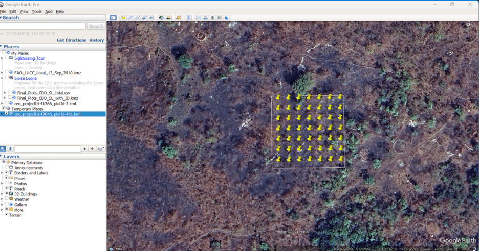
The interpretation key begins with detailed information in a section about the “Assessment Unit.” This section includes information about the plots in CEO, including their size, the number of samples per plot, and their arrangement. The key then provides an overview of the different levels of land cover classes and provides clarification for class representation in a section on “Land Cover Class levels for Sierra Leone”. The organizational structure of the classes is presented in a section on the hierarchical “Decision Tree,” which guides users through the general land cover identification process.
Following this overview, a section on “Point Interpretation Guidance” presents each land cover class with identical satellite images, following the hierarchy previously discussed in the decision tree. Additionally, a section called “Identify and Assign Land Covers” provides crucial features and identifying indicators, which are helpful and derived from discussions with country experts.
The last two sections of the interpretation key provides guidance for robust land cover identification. An example of the Savanna Forest CEO class follows.
Information contained in the “Point Interpretation Guidance” section includes the tiered land cover classes and example satellite imagery.

Insights provided in the “Identify and Assign Land Cover Types” section include comments from interpreters to help identify the class. These country land covers specific instructions were collected during the workshop and recorded for future insights into image interpretation. Mostly the confused land covers were discussed, creating additional guidance for these land covers. For example, the instructions provided for Savanna Woodland:
Savanna Woodland:
Following this interpretation key, 7,165 plots and 351,085 samples were interpreted. The point interpretation was conducted by 17 interpreters, with 8% of the plots checked by a Subject Matter Expert (SME) using CEO’s built in QAQC features. Data quality was assured by an extensive check of around 50% of plots and was found to be very satisfactory.
This data is now being used to prepare the sampling design for Phase Two of the NFI. The data is also being used to calculate and report the area of different forest types, their extent, canopy cover, and other information.
Sierra Leone’s interpretation key could be a good example for countries dealing with similar situations or issues with land cover class identification. If you wish to explore the full Interpretation Key created and used for Sierra Leone, you can read it here: Interpretation Key for Sierra Leone Land Cover Identification.
If you have any questions, comments, or suggestions, or need assistance to create your own interpretation key feel free to contact Mondal Falgoonee Kumar by email.
A huge Kudos to the co-authors of the Interpretation Key, Jonathan Roberts (National Forest Inventory Expert in FAO), Iveren Change (National Forest Inventory Consultant), and all Sierra Leone Colleagues present in the training workshop.
CEO would like to thank its ongoing funders FAO, NASA–USAID SERVIR, and SilvaCarbon, a US government program. Thanks also to CEO’s technology partners: Norway’s International Climate & Forests Initiative for funding open high-resolution data availability; Planet for providing high-resolution imagery; and the Google Earth Engine team for creating a platform for Earth science data and analysis.
Collect Earth Online is working constantly to improve the user experience, and your feedback is invaluable. If you have ideas to share, please write to support@collect.earth.
Thank you!