In a world heavily driven by data, tools that facilitate accurate, collaborative, and efficient data collection are game-changers. One such tool is Collect Earth Online (CEO), an open-source online platform that enables scientists, decision-makers, and environmental enthusiasts to track and analyze changes in land use and land cover. For Diana B. Frimpong, Abena Boatemaa Asare-Ansah, and Dr. Catherine Nakalembe at the University of Maryland, CEO makes it possible to collect high-quality geospatial data to train models and perform ground truthing. The team uses CEO to tackle critical questions about cropland, and their work can help our global community of users identify new ways to use CEO.
As the urgency to develop reliable earth observation products such as cropland maps grows, Collect Earth Online has (CEO) become an increasingly indispensable alternative approach to ground truthing.
As a lab within the NASA Harvest consortium (University of Maryland), we use CEO to collect high-quality geospatial data for model training and ground truthing purposes for various land cover monitoring projects. For our classification tasks, training data is essential for predicting specific land cover classes and aids in the identification of rapid land cover changes. Ground truth data is used as an independent evaluation to validate satellite-derived land cover products by comparing them to what is known on the ground. CEO seamlessly integrates geospatial data sources such as Google satellite, Mapbox satellite, and Planet monthly data, enabling geospatial data labeling. This flexibility allows us to assign categories or attributes to specific data points.
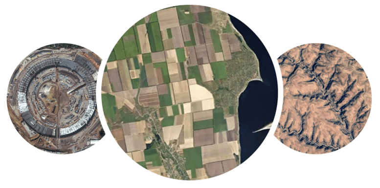
Africa has a complex and heterogeneous landscape with limited access to high-quality ground truth data. As part of our crop mapping projects for various countries in the region, we collect crop and non-crop data points to produce cropland maps and to assess the quality of satellite-derived cropland products. These spatially distributed data points are imported into CEO and correctly labeled by independent analysts. The quality of final cropland map products is significantly impacted by labeling accuracy and efficiency.
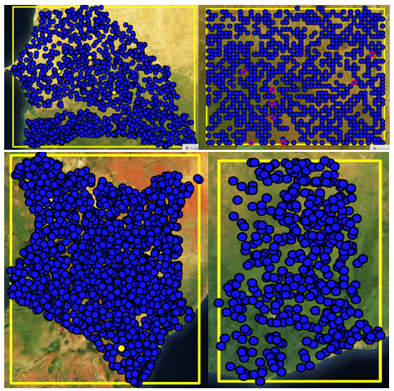
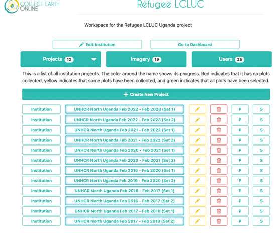
For instance, there is our NASA LCLUC project, which leverages earth observation techniques to map agricultural LCLUC hotspots in refugee-hosting communities in Uganda. For a project heavily dependent on crop and non-crop sample data for annual cropland maps, CEO allowed us to meticulously collect training and ground-truth labels to train machine learning models and evaluate the accuracy of our high-resolution cropland maps. To do this, we created annual labeling projects in CEO, generating two sets of the sample data at the same locations. This efficient approach enabled dual independent labeling, ensuring consensus on the land cover classes.
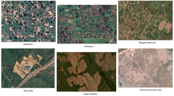
Furthermore, the ability to access high-resolution satellite imagery enables analysts to easily discern patterns and features in the landscape and appreciate phenological changes in predominantly smallholder farming communities in Uganda. It is exciting to see how Collect Earth Online provides opportunities that advance humanitarian mapping efforts and contribute to the greater social good.
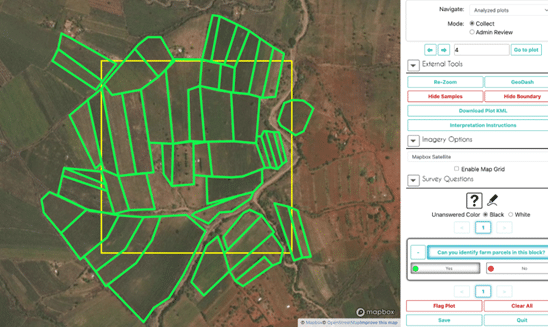
Another project, which involved developing a regional yield sampling framework, required ensuring that final sample blocks selected for yield data collection did have crop fields in them and were easily accessible. Digitizing our sample blocks was a critical step towards ensuring access, forming the basis for modifications, and aiding decision-making during field campaigns. To achieve this, we utilize the polygon tool in CEO to create boundaries around farm parcels visible on selected satellite imagery that fall within our 50m bounding box generated from our sampling frame.
More than just a tool, Collect Earth Online serves as a gateway to useful insights about our world. Its adaptability, usability, and collaborative capabilities make it indispensable for students, scientists, and organizations working on environmental-related projects. If you’re looking to maximize the efficiency of your data collection process and discover new insights, give Collect Earth Online a try.
The CEO would like to thank its ongoing funders. Thanks also to CEO’s technology partners: Norway’s International Climate & Forests Initiative for funding open high-resolution data availability; Planet for providing high-resolution imagery; and the Google Earth Engine team for creating a platform for Earth science data and analysis.
Collect Earth Online is working constantly to improve the user experience, and your feedback is invaluable. If you have ideas to share, please write to support@collect.earth.
Thank you!